Natural Attractions of Ethiopia
Danakil Depression
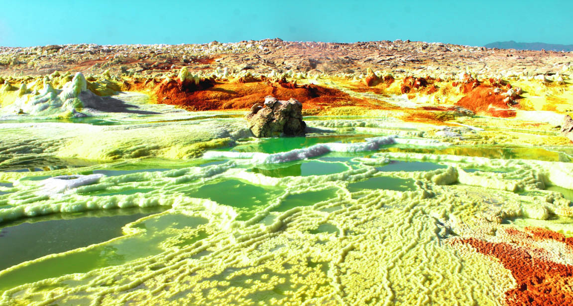
The Danakil Depression is located in the Afar region in northeastern Ethiopia, close to the border of Eritrea and Djibouti. It’s considered one of the hottest (average 34,4 C), driest (100-200 mm rainfall/year) and lowest regions on earth (125 meter below sea level). It is also one of the most geologically active regions with three tectonic plates meeting at the Afar Triple Junction. When tectonic plates move apart like at Danakil, it creates lave lakes, hot springs, geysers and fissures in the ground. Here the toxic gases saturate the air, the pH is extremely acidic and saline and metal concentrations are very high.
Simien Mountains National Park
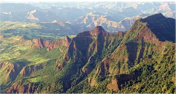
The Simien Mountains national park is the one of the national park of Ethiopia located in North gondar Zone of Amhara Region. Its territory covers the simien mountains and includes Ras Dejen, which is over 4543 metres, the highest point in Ethiopia.
The park is home to a number of species, including the Ethiopian wolf, gelada baboons and walia ibex found nowhere else in the world and endemic to Ethiopia.
More than 50 species of birds inhabit the park, including the impressive bearded vulture or lammergeyer, with its 10- foot (3m)wingspan
Omo National Park and River
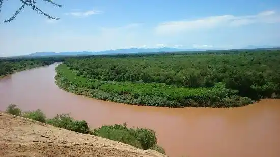
Omo National Park is on the west bank of the Omo River in the lower Omo valley. The park is 140 km long, stretching from the Neruze River in the south to the Sharum plain in the north, and up to 60 km wide where the Park Headquarters are situated. There are three hot springs, and the park is crossed by a number of rivers, all of which drain into the Omo. The park is home to the Surma, Mogudge and Dizi peoples, with the Bume (yanyatong) making much use of areas in the south and the Mursi crossing the Omo River from the east. These people are pastoralists and hunter-gatherers, but also cultivate a few crops on the river levees, and make extensive use of the river resources.
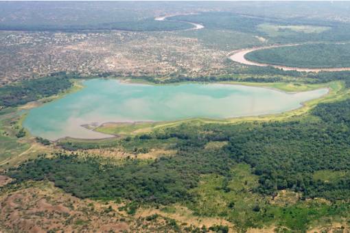
Lake Tana
 Lake Tana is the largest lake in Ethiopia and the second largest in Africa. Lake Tana covers an area of 3,000 square kilometers, while its catchment area covers 15,000 square kilometers. Four major rivers feed into the lake, including Gilgel Abbay, which flows from the south, Gumera and Rib from the northeast and Megech from the north. The Tana basin connects about two million people, the majority of whom subsist on agriculture, while the two largest cities in the Amhara region, Bahir Dar and Gondar, lie within the basin.
Blue Nile Falls
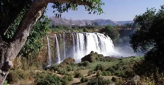 The Blue Nile Falls are located in the Ethiopian plateau, passing the Blue Nile River. It is one of the greatest falls in Africa. The Blue Nile River is a tributary of the Nile River which is the world’s longest river. It originates at Lake Tana. The waterfall is located on the upper course of the river. To reach the falls, which is about 35 kilometers (22 miles) away from Bahir Dar, drive south from Bahir Dar for about half an hour, and stop at Tis-Isat village. A rewarding but longer trek is to walk along the east bank all the way to the back of the falls; crossing the river by tankwa.
Lower Omo Valley
The Lower valley of Omo is located in south- western Ethiopia.
The age old sedimentary deposits in the Lower Omo valley are now renowned for the discovery of many hominid fossils, that have been of fundamental importance in the study of human evolution ancient tools and dating back 2.4 million years ago have been discovered there. The area is also home to a huge cultural diversity of people. The Lower valley of Omo is one of the unique places in the world in that so many various cultures inhabit such a relatively small price of land.